


Ticaboo Voting District, Garfield County, Utah
About
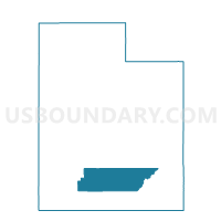
Outline

Summary
| Unique Area Identifier | 678846 |
| Name | Ticaboo Voting District |
| County | Garfield County |
| State | Utah |
| Area (square miles) | 1,537.77 |
| Land Area (square miles) | 1,508.62 |
| Water Area (square miles) | 29.15 |
| % of Land Area | 98.10 |
| % of Water Area | 1.90 |
| Latitude of the Internal Point | 37.89507040 |
| Longtitude of the Internal Point | -110.67172110 |
Maps


Graphs
Select a template below for downloading or customizing gragh for Ticaboo Voting District, Garfield County, Utah


Neighbors
Neighoring Voting District (by Name) Neighboring Voting District on the Map
- Boulder Voting District, Garfield County, UT
- Bullfrog Voting District, Kane County, UT
- Halls Crossing Voting District, San Juan County, UT
- Hanksville Voting District, Wayne County, UT
- Monticello North Voting District, San Juan County, UT
Top 10 Neighboring County Subdivision (by Population) Neighboring County Subdivision on the Map
- Kanab CCD, Kane County, UT (5,697)
- Blanding CCD, San Juan County, UT (4,904)
- Escalante CCD, Garfield County, UT (1,258)
- Hanksville CCD, Wayne County, UT (314)
- East Garfield CCD, Garfield County, UT (98)
Top 10 Neighboring Unified School District (by Population) Neighboring Unified School District on the Map
- San Juan School District, UT (14,746)
- Kane School District, UT (7,125)
- Garfield School District, UT (5,172)
- Wayne School District, UT (2,778)
Top 10 Neighboring State Legislative District Lower Chamber (by Population) Neighboring State Legislative District Lower Chamber on the Map
Top 10 Neighboring State Legislative District Upper Chamber (by Population) Neighboring State Legislative District Upper Chamber on the Map
- State Senate District 28, UT (94,905)
- State Senate District 27, UT (93,972)
- State Senate District 24, UT (85,639)
Top 10 Neighboring 111th Congressional District (by Population) Neighboring 111th Congressional District on the Map
Top 10 Neighboring Census Tract (by Population) Neighboring Census Tract on the Map
- Census Tract 9782, San Juan County, UT (4,904)
- Census Tract 4, Garfield County, UT (2,795)
- Census Tract 9791, Wayne County, UT (2,778)
- Census Tract 1301, Kane County, UT (2,297)